Puerto Libertad (Puerto Libertad)
Puerto Libertad is a village and municipality in Misiones Province in north-eastern Argentina. It is located in the Iguazu Department, 25 km south of Iguazu Falls and 5 km from the Paraná River. It has a population of 6,143 inhabitants (Census 2001).
A settlement in the area was created in the late nineteenth century with the arrival of factories which employed people to harvest yerba mate on the Paraná River.
The town, which was originally known as Villa Veinticinco de Mayo, developed steadily, and already had its first school in 1927, and a year later a post office. The census of 1929 indicated a total of 1,190 inhabitants.
In 1950, the first Development Commission was created with the name of "17 de Octubre", in honor of the Peronist Party. Because of the political connotations of the name, the military coup that overthrew Juan Domingo Perón gave the town the name of Libertad in 1955. By 1971, the town had 3,500 residents.
The latest economic development was the construction of the Uruguaí Dam, 5 km from the village on the Uruguaí creek.
Map - Puerto Libertad (Puerto Libertad)
Map


Country - Argentina
 |
 |
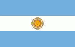
| Flag of Argentina | |
The earliest recorded human presence in modern-day Argentina dates back to the Paleolithic period. The Inca Empire expanded to the northwest of the country in Pre-Columbian times. The country has its roots in Spanish colonization of the region during the 16th century. Argentina rose as the successor state of the Viceroyalty of the Río de la Plata, a Spanish overseas viceroyalty founded in 1776. The declaration and fight for independence (1810–1818) was followed by an extended civil war that lasted until 1861, culminating in the country's reorganization as a federation. The country thereafter enjoyed relative peace and stability, with several waves of European immigration, mainly Italians and Spaniards, radically reshaping its cultural and demographic outlook; over 60% of the population has full or partial Italian ancestry, and Argentine culture has significant connections to Italian culture.
Currency / Language
| ISO | Currency | Symbol | Significant figures |
|---|---|---|---|
| ARS | Argentine peso | $ | 2 |
| ISO | Language |
|---|---|
| EN | English language |
| FR | French language |
| DE | German language |
| GN | Guarani language |
| IT | Italian language |
| ES | Spanish language |